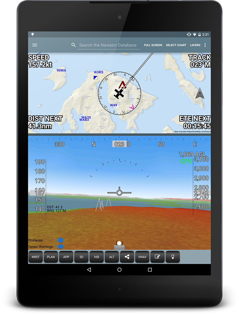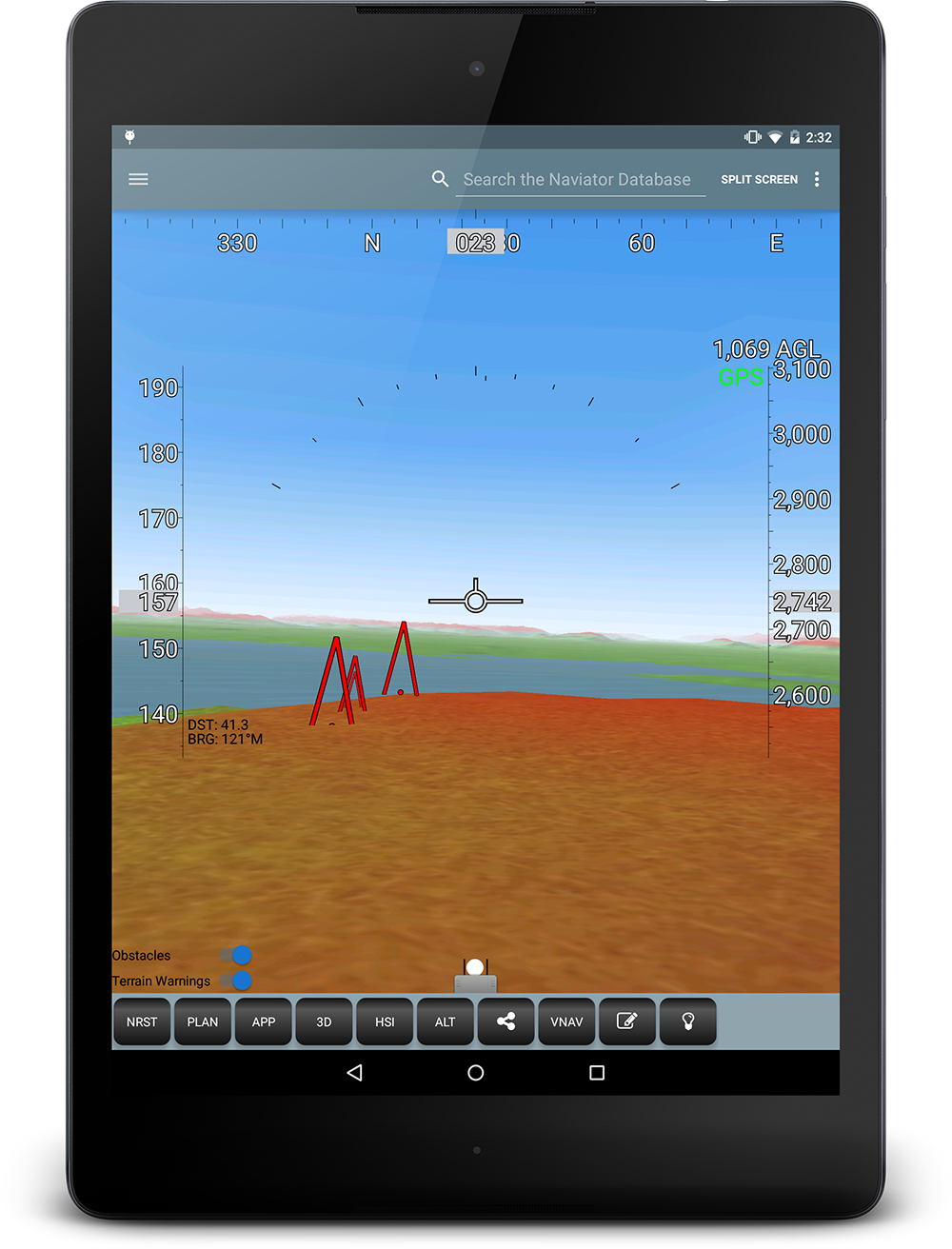
3D Synthetic Vision, Terrain and Obstacles
Naviator's sophisticated 3D synthetic vision feature combines a high-resolution terrain database with GPS data to create a visual representation of the aircraft's surroundings - in full 3D! Mountains, lakes, obstacles and towers appear as if you were looking out the windscreen.
Obstacles and towers are displayed at their real-world heights and are color coded to warn of potential collision risks. If you get too close to an obstacle it will start flashing red and white.
Terrain 500 feet below, or above the aircraft's altitude is tinted red to warn of potential collision risks.